Wave Cyclone
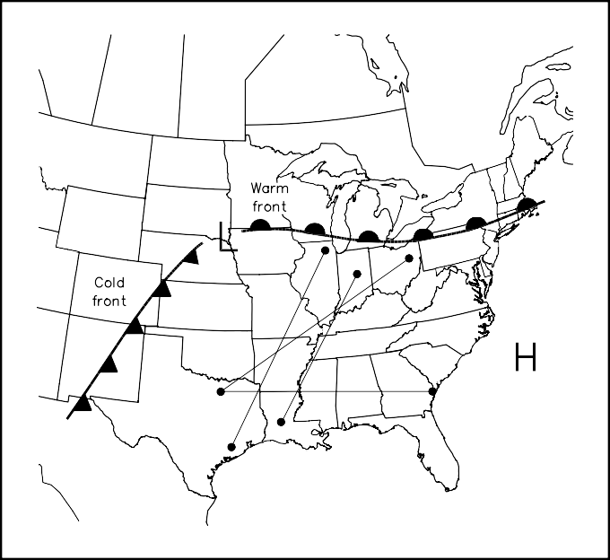
The wave cyclone is a more dynamic weather system that usually appears during the spring over the middle part of the American continent. The wave begins as a disturbance along a bound- ary between cooler northern and warmer south- ern air masses. Southwest of the disturbance, a cold front forms and moves rapidly eastward, while a warm front moves slowly northward on the eastward side. When the wave is in its open

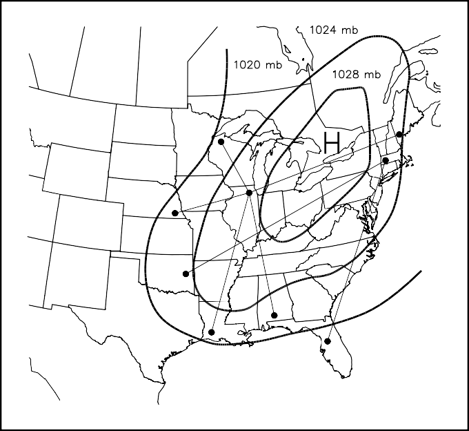
Fig 21.27—Surface weather map for September 13, 1993, shows that the eastern US was dominated by a sprawling high-pressure system. The shaded portion shows the area in which ducting condi- tions existed on 144 through 1286 MHz and higher.

Fig 21.28—Surface weather map for June 2, 1980, with a typical spring wave cyclone over the south- eastern quarter of the US. The shaded portion shows where ducting conditions existed.
position, as shown in Fig 21.28, north-south radio paths 1500 km (930 mi) and longer may be possible in the area to the east of the cold front and south of the warm front, known as the warm sector. East- west paths nearly as long may also open in the southerly parts of the warm sector.
Wave cyclones are rarely productive for more than a day in any given place, because the eastward-
moving cold front eventually closes off the warm sector. Wave cyclone temperature inversions are created by a southwesterly flow of warm, dry air above 1000 m (3200 ft) that covers relatively cooler and moister gulf air flowing northward near the Earth’s surface. Successive waves spaced two or three days apart may form along the same frontal boundary.
